Rees-Dart Track

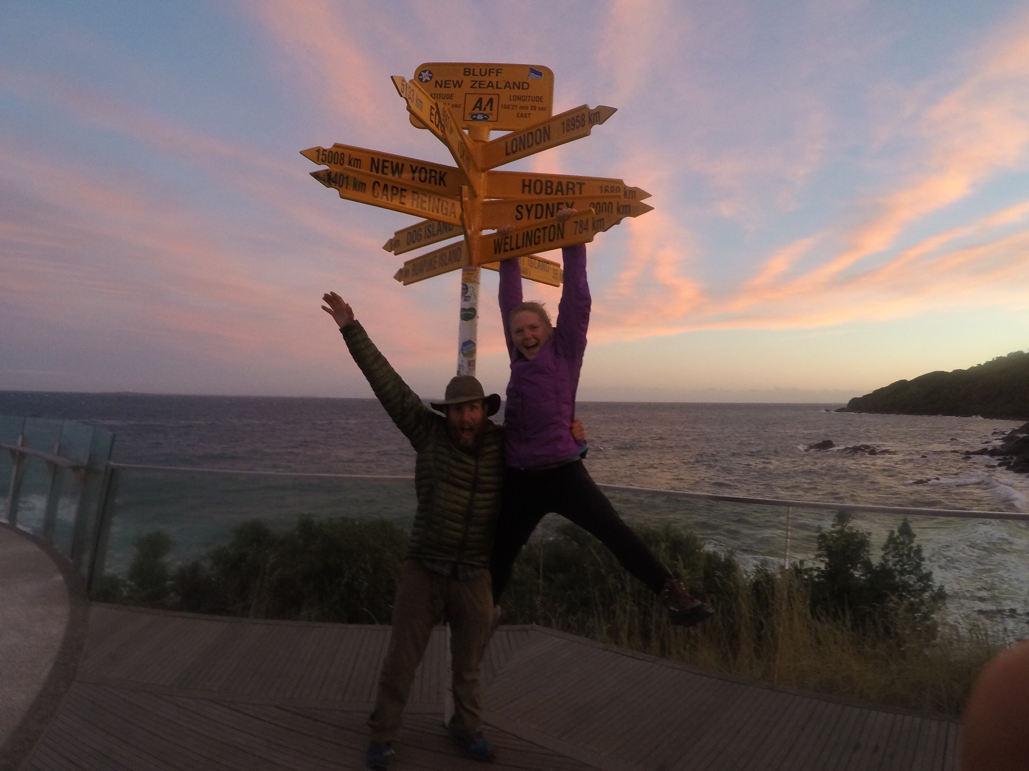
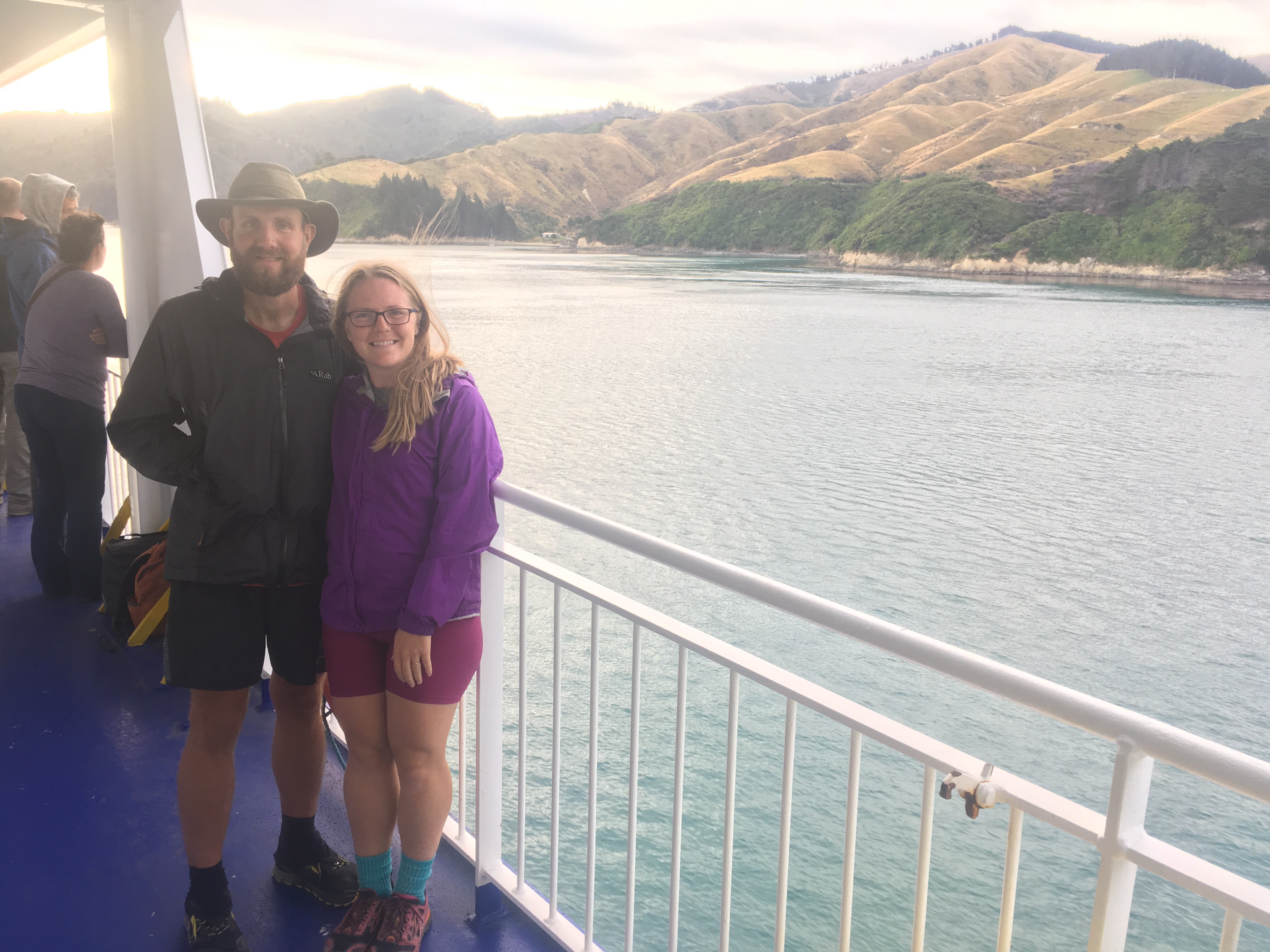
We’ve been feeling really nostalgic lately as winter slowly sets in because this was the time last year that we were packing and preparing for our greatest adventure yet.  Yesterday morning, Facebook showed me a memory from a year ago: my post informing everyone that Ben and I could no longer be reached by our phone numbers, as we were heading out the next day to New Zealand.  It reminded me that I have a couple more weeks of New Zealand adventures yet to write about to complete this travel blog / journal.  I can’t believe how quickly these past 7 months have flown by!

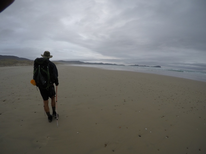
After the Routeburn track, we had a couple more shorter walks that we wanted to do.  We started to realize that even with a rental car, it was a challenge to plan these logistically because not many of the trails were looped, beginning and ending in the same carpark.  We were drawn to the Rees-Dart track for many reasons: we had heard amazing things about it (I kept hearing people talk about the “Restart” track… thankfully Google figured out what I was talking about!), it had recently re-opened after a massive landslip along the Dart river, and it was advertised as a “loop” track.  Once we started our plans however, we realized that while the “loop” started and ended sort of near each other as the crow flies, they are actually something like 25/30 kilometers apart via road.  We accepted the fact that we’d probably have to add another day of just walking from the end of the track back to the car with our fingers crossed for a hitch on the super remote roads, or Ben would have to do another really long gravel-road run.

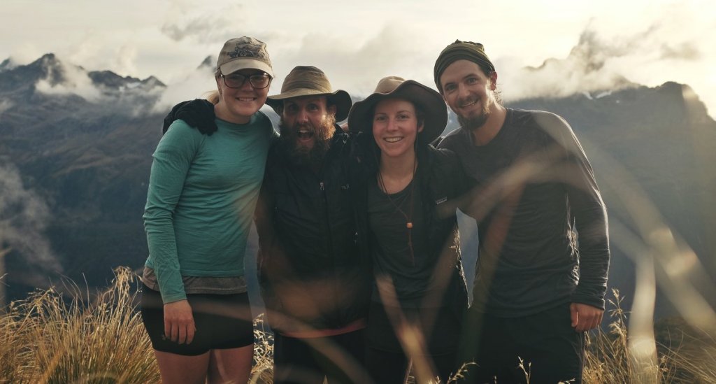
Enter:  FRIENDS to save the day!  As Ben was running from one carpark to another to pick up our car after the Routeburn/Greenstone track, he ran into our friends Jaysen (from Seattle) and Maxime (from Germany) who were hitching to the start of the Rees-Dart track.  Ben thought they planned to do the trail in the opposite direction, so the two of us hatched a plan (unbeknownst to the guys!) that we’d see them somewhere along the trail and give them our rental car keys to have them pick us up on the other side, saving all of us a long walk or a tough hitch.

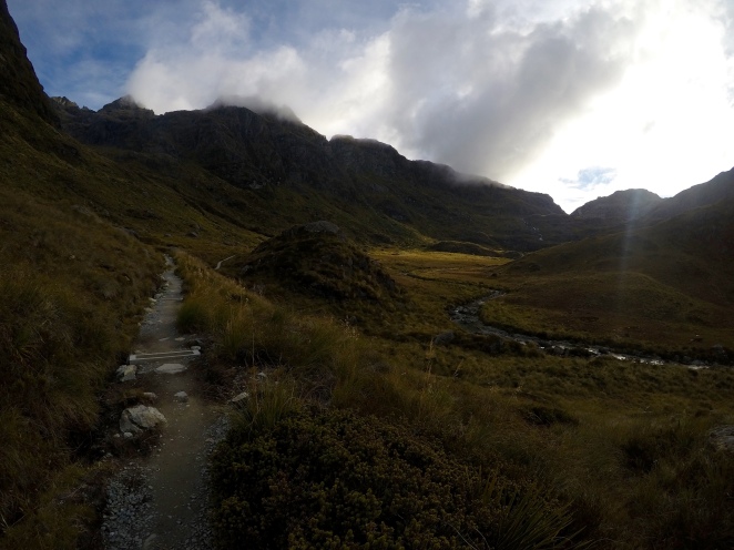
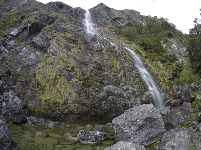
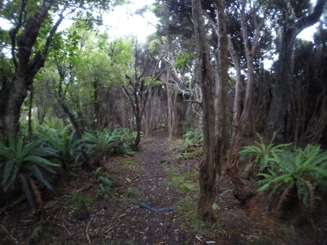
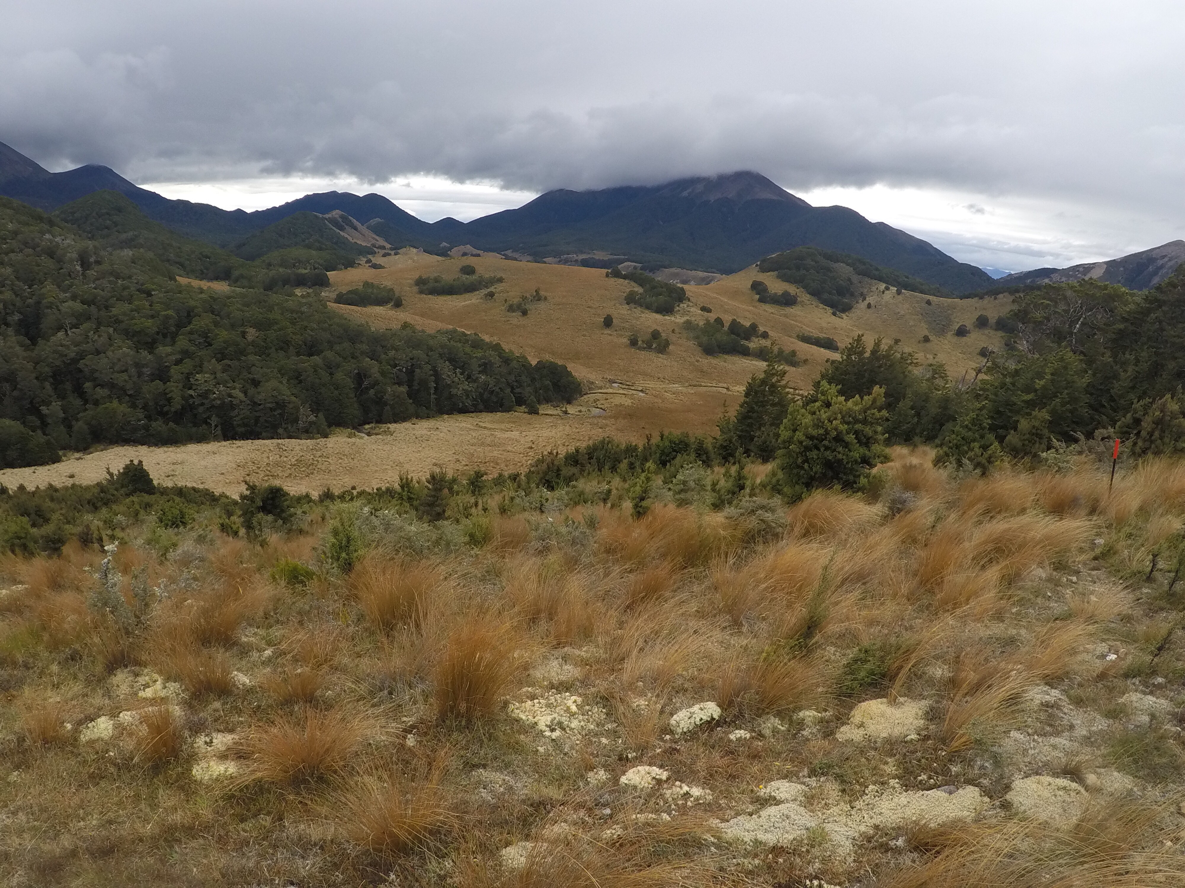
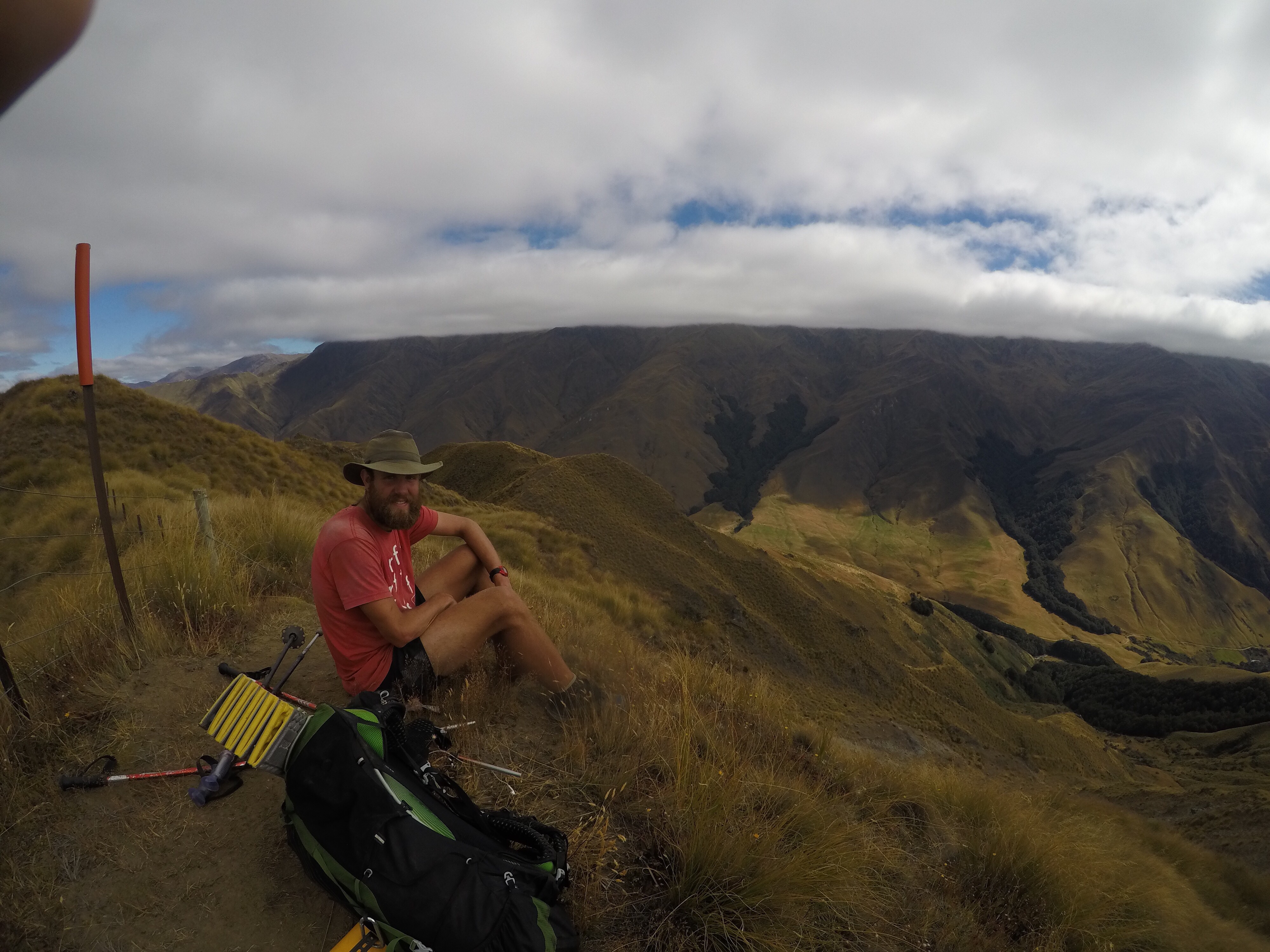
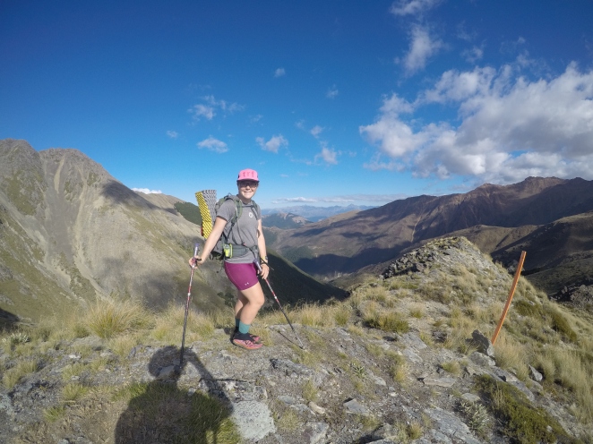
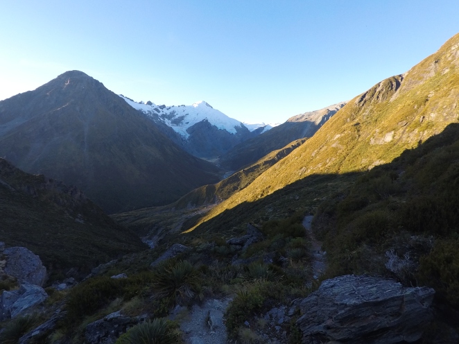
The next morning, we set out and walked along the Rees river valley, then climbed up up up to and over Rees Saddle.  It was a really gradual climb until the very last bit, which felt a little reminiscent of Waiu Pass, just shorter. We took in the view, then started our descent, which really challenged my fear of heights.  The trail, while well-maintained, sidled along a steep drop down to Snowy Creek.  The view was absolutely gorgeous with a huge cliff wall on the other side of the river, so I paused my focused, don’t-fall-off-the-edge walk now and then to take in the sights and sounds of the bright blue water below and the vast mountains in the distance.  The last bit of the descent was super steep and actually really fun, especially once we could see Dart Hut in the distance.

DCIM101GOPROGOPR2010.JPG

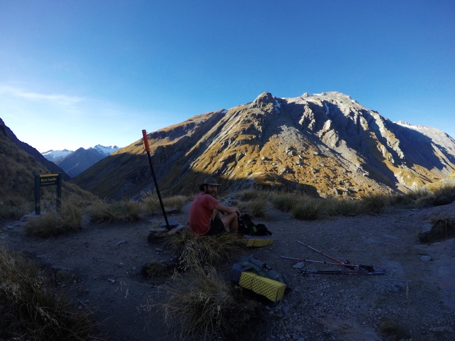
At the top of Rees Saddle


DCIM101GOPROGOPR2013.JPG

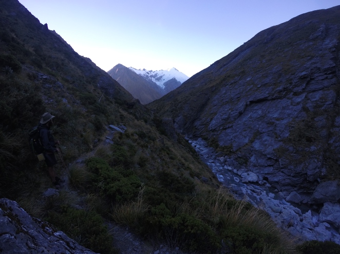
Descending along Snowy Creek


DCIM101GOPROGOPR2020.JPG

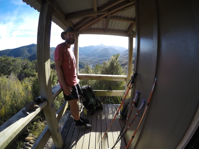
Dart hut was large and really nice, with flushing toilets outside AND some familiar faces waving at us from inside – Jaysen and Max!  We filled them in on our plot, and they agreed.  We decided we’d all base-camp at Dart Hut and do a day hike up to Cascade Saddle the next day, then walk the rest of the way in opposite directions the day after.

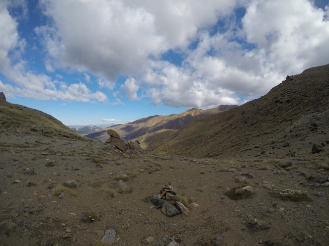
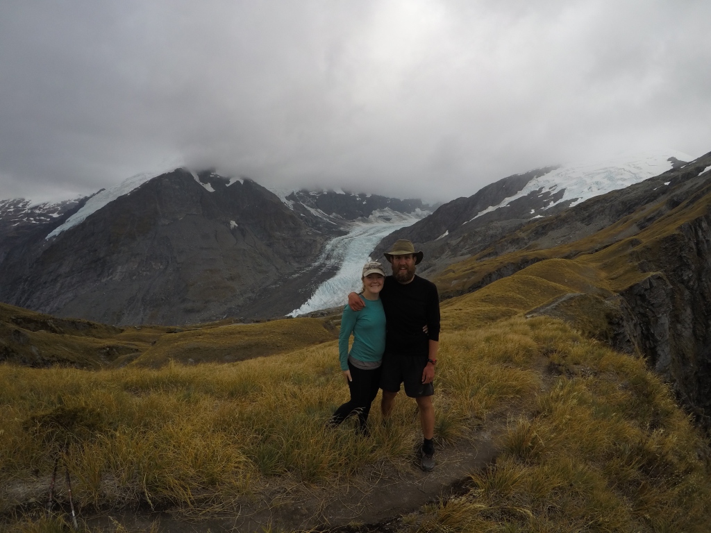
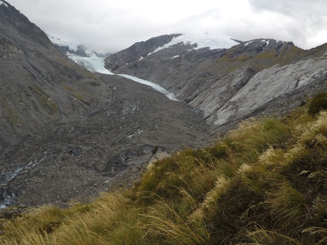
The walk up to Cascade Saddle was incredible.  It started with a gentle climb along the Dart River to Dart Glacier, the source of the river.  This was the first glacier I’ve seen up close, and it was so cool.  As we were walking toward it, I kept hearing rumbles and cracks, and I thought a storm might be heading our way.  Ben listened a few times and assured me that it was probably just “glacier sounds.”  Once we got closer, it became more clear that these were just the regular sounds of the huge ice formation.  Really eerie!
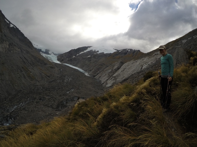
DCIM101GOPROGOPR2034.JPG

Dart Glacier!

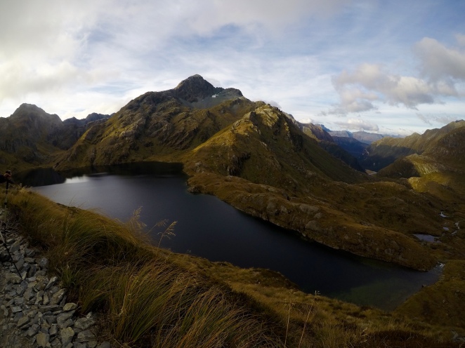
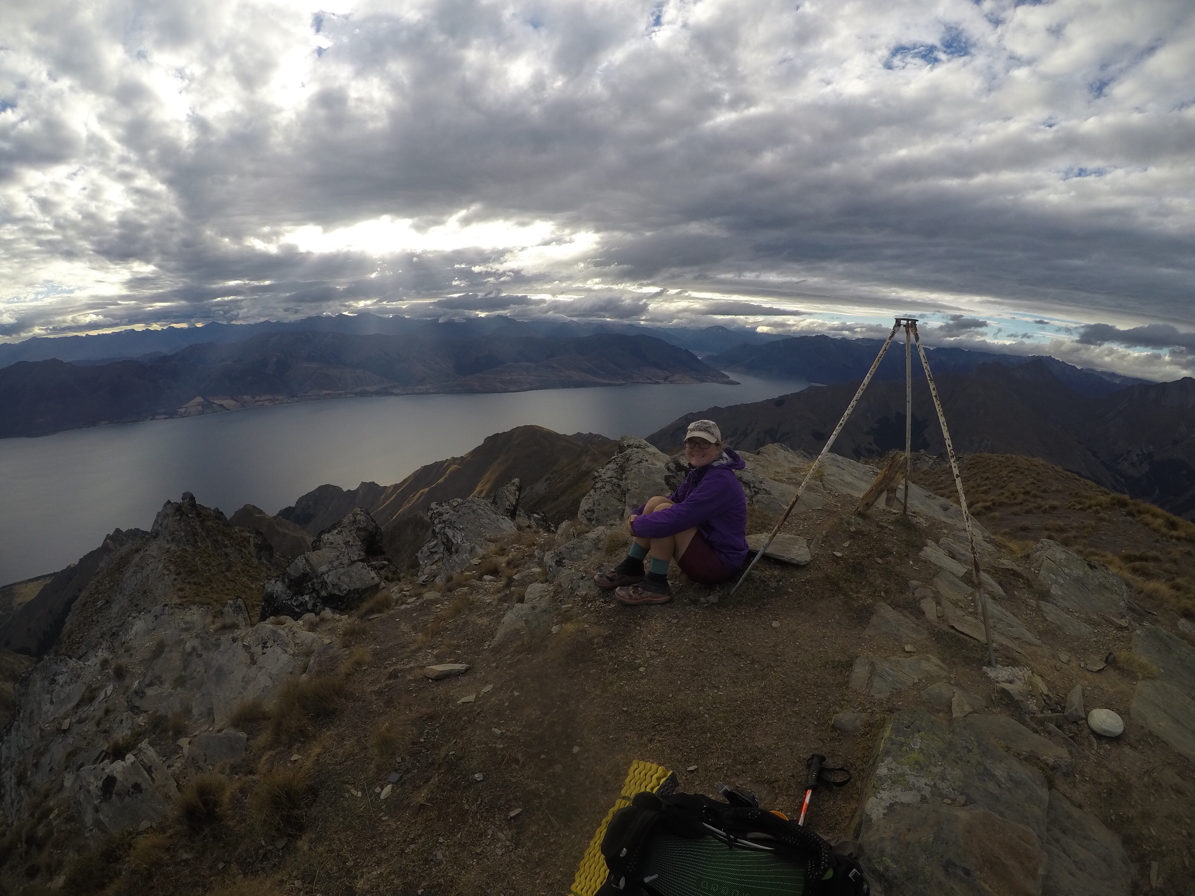
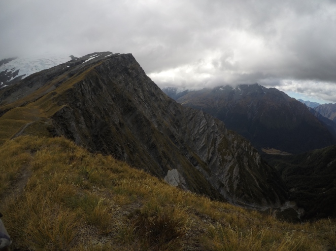
From there, the climb got much more intense, winding and switchbacking up the side of the mountain.  The view at the top of Cascade Saddle was well worth the climb, with a view of the glacier and Dart River on one side, and Mount Aspiring Park on the other side.  Unfortunately, the top of Mt. Aspiring was hiding in a cloud, but that didn’t make the view down into the valley any less amazing.

DCIM101GOPROGOPR2036.JPG

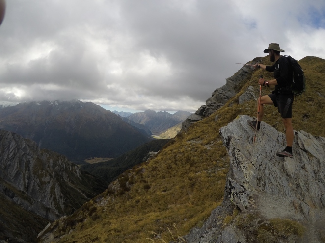
At the top of Cascade Saddle

DCIM101GOPROGOPR2042.JPG

Top of Cascade Saddle

The day trip up and back also racked up a few more points on our “New Zealand Bingo” card – it was the first time seeing some really cool NZ wildlife up close!  First, on the way up, we were followed by a group of Kea, a high-altitude parrot.  We saw a few of these near Arthur’s Pass, but they were just ripping apart someone’s car.  These ones were more in their natural mountainous habitat, just looking for opportunities to rip apart our packs. These birds are incredibly intelligent and bold, and have become something of a pest in really touristy areas because they’ve learned where they can find food.  Despite their naughtiness, they are beautiful, cherished, and heavily protected in the country, and unfortunately the influx of tourism hasn’t been great for the species.

We also saw a Weta, a really strange-looking grasshopper-like insect endemic to New Zealand.  As you can see in the photo, it was just chilling next to the trail on a tissue that someone had apparently dropped.  I took the photo, and then had a fairly significant moral dilemma trying to decide whether to leave the Weta undisturbed, or try to sneak the tissue out from under it to throw it away.  Whatever you think was the right decision, I probably did that. 😉

DCIM101GOPROGOPR2032.JPG

The Glacier AND a Kea (in the middle, a little below the ice in the photo)
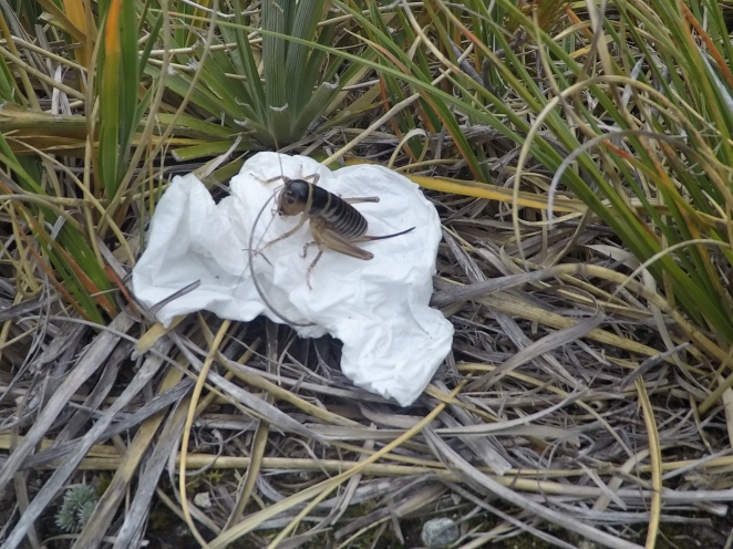
DCIM101GOPROGOPR2047.JPG

Weta

The wind picked up and it started to cool down, along with some mist here and there, so we made our way pretty quickly back down to the hut.  We enjoyed chatting with some other hikers that night – a group of 3 made up of an American, a Canadian, and a New Zealand local.  The local girl told us all about her job as a Kiwi Ranger – she works to help track the breeding habits of the Kiwi (birds) in a specific area and take measures to make sure the babies are protected and can grow and thrive.  One more successful measure was actually removing the eggs from the nest to incubate them and raise the babies until they’re big enough to be able to fight off things like possums and stoats.  I got a little sad about the babies being taken from their mothers, but she reminded me that an incubated baby Kiwi is better than a dead baby Kiwi!  Part of the reason kiwis are so endangered is because Kiwis just don’t reproduce very often and babies are pretty much defenseless for the first several months of their lives.  Their predators, on the other hand, tend to reproduce rapidly AND have no natural predators of their own.

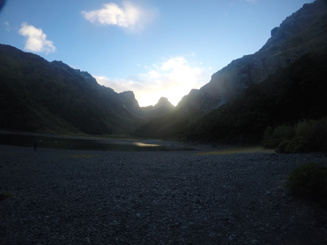
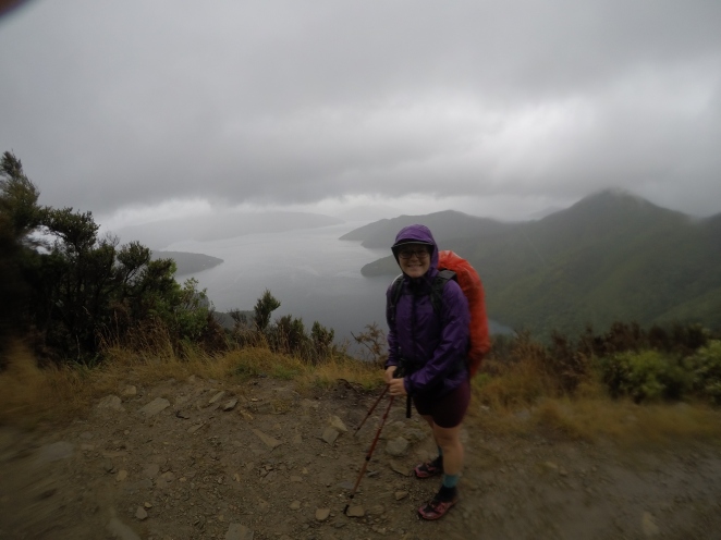
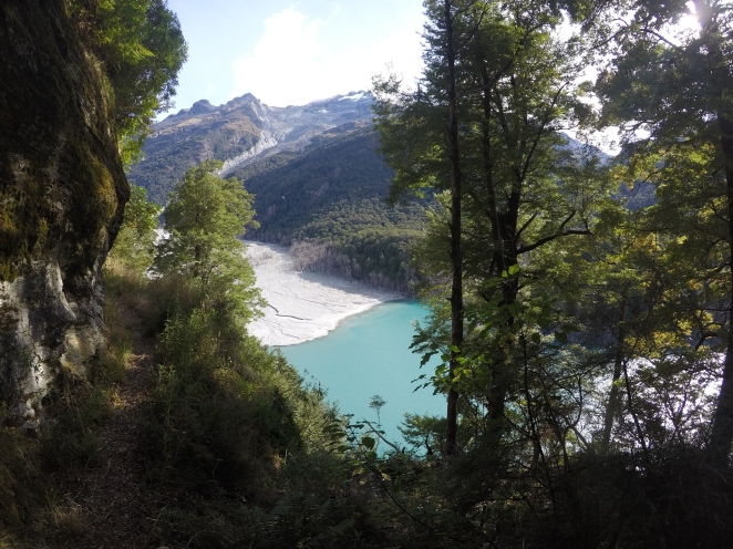
The next morning started out a little wet and cold, but the sun later came out and warmed things up.  The trail was super easy going along the Dart river valley until we got to the point of the trail that was damaged from the land slip.  In many areas, you could see where the original trail had collapsed into the river, as we were working our way along a really rough, rooty, new “TA-style” track navigating lots of fallen trees. We tried to move fast, though, because we didn’t want Jaysen and Max to have to wait for us for forever with the car.

It was actually really cool to see where this massive slip had occurred.  The natural disaster had actually created this really strange, beautiful landscape.  The river was almost lake-like in some places, where deadened trees still stood tall out out of the bright blue water.
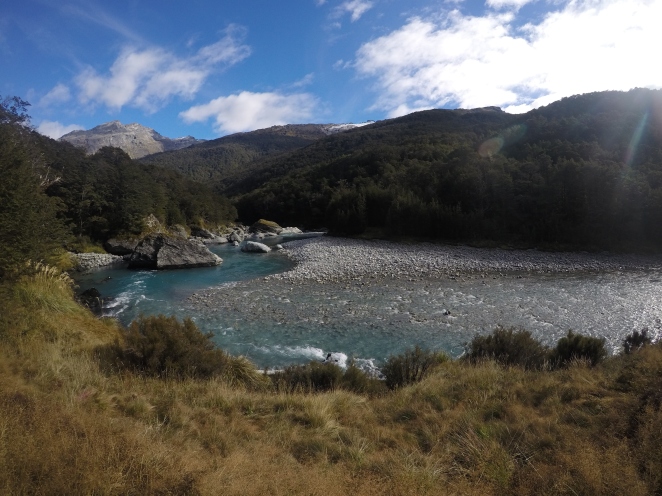
DCIM101GOPROGOPR2053.JPG

Dart River

DCIM101GOPROGOPR2056.JPG


After about an hour, however, we got back on the original, well-maintained, flat trail along the river and soon we could see the small carpark from a distance.  Once there, we waited for about an hour, reading our books and swatting away sandflies, until we heard our rental car coming down the rough gravel road blasting country music, which I believe was Max’s new obsession at the time.  We drove the hour or so back to Glenorchy, where we dropped off the guys with a friend they knew there.  We said “see ya later” because we invited them to spend some time at our AirBnB in Te Anau.

Ahhh, sad thing:  I just had to really think about where we stayed that night!  The specifics are fading so hard, which means I need to hurry up and finish writing these stories!  But anyway, now I remember:  Ben and I drove back toward Queenstown where we set up camp in a DOC campsite – 12 Mile Delta.  We thought about going into town to get food and beer, but decided that we should keep eating all the trail food that we had purchased the week before, since we had already decided to skip the final Fiordland hike we had planned.  Because the days were getting shorter, the nights colder, and the weather more unpredictable, we decided instead to spend a couple more days playing tourist!

Another Great Walk: Routeburn

Another 6 weeks have passed since we’ve been home, and I’m beginning to realize really how quickly a whole experience can start to feel like a dream.  The details get a little fuzzy and “real life” gets in the way of thinking about and reflecting on our adventure all the time.  Which is good, right?  It’s just the way of things, or at least the way things should be.  We experience something fully while we’re doing it, and then we let it go.  We file it away with our fond memories, our crazy stories, our life lessons, and the things we know about ourselves.  Our past experiences continue to influence us in ways that we don’t even fully realize, but they’re not at the forefront of our thoughts anymore.

But it’s also a little sad to realize that life moves on, when the things that we’re moving on from were amazing.  So, before the details get a little too fuzzy, I have a few weeks of New Zealand stories still to write down.  This blog was a great way to stay connected and keep you updated, but I know now that mostly I did it for me, for us.  The same is true for our video compilation, which can be found here.  Sure it’s fun for you to watch, to get a feel for what the hell we were up to for 5 months on the other side of the world, but it’s really for us.  To watch again and again, which I’ve already done, by the way.

Anyway, my last post finished with us returning to “our room” at the Bluff Lodge after returning from Stewart Island. The next morning, we starting walking out of Bluff to try to get a hitchhike to Invercargill.  Once again, we had a crazy easy time getting a ride – as soon as we got close to the edge of town we started “walk-hitching” where we just kept walking, but threw our thumbs out whenever we heard a car coming up behind.  The first car we tried pulled over, and we climbed in with a mom and her sleeping baby.  This is about the 4th baby I’ve ridden in the backseat with, which I think is incredible proof just how normal and safe hitch-hiking is viewed in New Zealand compared to the U.S.  She said she’s always keeping her eye out for people needing rides when she heads to up to Invercargill.  Once in the city, we popped in to pick up my damn glasses.

After walking a couple of miles, we started hitching.  After what seemed like forever, we got picked up by a woman who said she could take us just past the next highway junction, where someone would be more willing to pick us up.  We weren’t there long before we gave an excited thumbs up to a badass classic Land Cruiser coming our way, which pulled over to pick us up.  The driver was a super nice guy, originally from South Africa, who is now a plumber (and a devoted Land-Cruiser caretaker) in NZ.  To be honest, I couldn’t hear any of this from the back seat because the car was so loud, but this is what I picked up from Ben after.  Then, with about 100 km left to Queenstown, we were picked up by a sweet older lady making her way home from the Invercargill airport.  We listened to 60s music while she told us about how her home, Arrowtown (just near Queenstown), has been changing and growing so quickly, and all of her friends are moving away.  So, while it kills her because the area is so gorgeous (it really is!), she’s moving closer to one of her daughters and her family in a more rural area of NZ.

Thinking back, it seemed that Ben and I had an unspoken agreement about who would be sitting in the front and the backseat when taking rides.

  1.  If it was a single guy picking us up, Ben would sit in the front and I would sit in the back.
  2. If it was a single woman picking us up, I would sit in the front and Ben would sit in the back.
    • UNLESS there was a baby in the backseat, in which case I would keep up the baby conversation, google eyes, and funny faces in the back seat, while he would continue to act like an adult in the front seat.

Anyway, the woman dropped us off very near the Frankton Holiday Park where we had reserved a cabin for the night.  The next morning, Ben went to the Queenstown airport to pick up our rental car.  We spent the day in Queenstown, did some re-supply, etc.  Somewhere in the midst of the past couple of days, we had heard from our friends Andrew and Alexa, the New Yorkers who we had hiked much of the North Island with, that they were pretty close to Queenstown and were thinking about re-routing a little bit to do the Routeburn track.  Our plan was to do the Routeburn track next, and we anticipated being in Queenstown about the same time, so we tried to get in touch with them about meeting up.  If you recall, to get back to the Te Araroa out of Queenstown, hikers have to get around the huge lake to a remote trailhead, which can take a long day of hitchhiking (and cause hikers to become so desperate that they’ll leave prescription glasses behind JUST to not give up their hitchhike….. ring a bell?).  We figured we could help them skip that stress and possible possession-losing by at least giving them a ride where they needed to go!

We were about to give up on hearing from them and just head out of town, when we got a text that day that they were a few hours from Arrowtown (the town just before Queenstown).  They weren’t sure what their plan was yet, but we knew that we could at least trail-magic them and bring them beer to drink once they got off the trail.  Ben and I went to the legendary Fergburger while we waited. Review: the Big Al was really… meh, actually…. while the Chief Wiggum was quite unique and delicious! Overall, overrated.  I’m sure things would have been different had we made the trip to eat there while we were on trail and still had our intense hiker-hunger.

Around 5pm, Ben drove us (on the right side of the car and the left side of the road) to  Arrowtown, and were able to welcome Alexa and Andrew back to civilization after the intense Motatapu track.  We all peer-pressured each other and found a compromise – Ben and I would stay in town one more night so they could resupply in the morning, then we’d all drive out to the Routeburn trailhead the next day to hike the 30km Great Walk together.  And instead of starting really early and doing the whole thing in one day, we decided to split it into two days.  Since it’s a Great Walk, the huts and campsites are often booked months in advance, but we somehow stumbled upon one vacant campsite about halfway through the track.  We celebrated with bourbon and beer, and exchanged stories from the South Island.

The next day we ran a few errands and drove out to the remote Routeburn trailhead (via Glenorchy where we stopped for dumplings!) and started hiking by about 2 pm.  The Great Walk tracks are pretty well-maintained and easy going, so we knew we could do it quickly.  But they also cater the trail, lodging, and marketing/planning suggestions so that almost anyone with moderate fitness can do it.  The 20-some km that we planned to do that day was estimated to take 2 days, or about 10 hours of hiking.  But we knew ourselves better.

We spent a few minutes at the first “hut” (aka hotel, mansion) to take in how the “other half” lives.  Once we continued on we started running into a few hiking tour groups coming in from the other direction, and one of the apparent hiking guides asked where we were headed and commented that we were getting a late start.  Alexa confidently stated that “well, we’ve been hiking the TA, so…. ” to which the hiking guide quickly responded “oh yeah – you’ll be right!”

DCIM101GOPROGOPR1996.JPG

Mountain Valley

It was at this point, when we reached the mountain valley, that the scenery became REALLY incredible.  Truly truly a Great Walk.  And because of our slightly late start, we caught the start of sunset while up there.  The mountains looked like they were on fire!

DCIM101GOPROGOPR1997.JPG

Lake Harris

We walked at a pretty good clip to make sure we got to our campsite before dark, and we had a pretty steep, rocky descent down to the beautiful Mackenzie Lake.  We had to use our headlamps for the last 20 minutes or so of the walk and walked right by the Mackenzie luxury hut to the Mackenzie Lake campground. We ran into the warden on our way in, and he was surprised to see us arriving so late.  He point us to the last open campground, and we were disappointed to realize that it was a little rocky patch with a sort of small square platform in the middle.  We certainly couldn’t fit two tents on it, and even if they were on their own, Alexa and Andrew’s Zpacks tent would hardly work because it needs to be staked up.  So, we looked up at the cold, clear night sky, and decided to cowboy camp.  We lined up our sleeping pads and sleeping bags side by side along the platform and just slept under the stars.  We figured that if it did start to rain, we could make a break for the eating shelter and sleep under there.

It turned out to be the perfect clear, chilly, peaceful night to sleep under the amazing Southern sky.

DCIM101GOPROGOPR2001.JPG

Sunrise at Lake Mackenzie

We woke up in the morning and found that we only had a few kilometers left along the Routeburn track before we broke off to the Greenstone track to take us to the Greenstone hut, which is on the Te Araroa. It was a pleasant walk, and it was SO good to walk with our friends again.  Also, we crossed the highest swing bridge that I think I had encountered in New Zealand.

DCIM101GOPROGOPR2006.JPG

Earland Falls

We arrived to the Greenstone hut before dinnertime, and as we approached, we saw piles of shoes on the deck and surprised faces turning and staring at us from out the window.  As we got closer, we realized just how full the hut was, and we walked right on by without even looking in to set up our tents in the little camping area behind the hut.  The hut warden came to check our passes and said that there were already people sleeping on the floor in the hut, and it was incredibly hot in there with a fire going and multiple bodies cooking their dinners, so we’d probably be much more comfortable outside.  He warned us to keep our food inside, however, because there were some really fat and friendly possums in the surrounding trees.  We cooked our dinner on the porch, chatted with a few friendly hikers who also just needed to get out of that hut for a bit, then went to bed.  We were visited by a fat, friendly possum even though we didn’t have food — Ben swears that twice, a possum came up under the rainfly and just laid down next to him, almost cuddling with him through the tent.

The next day we parted ways with our friends, but not before hatching a plan to meet up again in about 5 days in Te Anau.  We planned to rent an AirBnB and hoped that our friend Simon would be finished with the trail by then and could join us as well.  It would take about that long for Alexa and Andrew to get to that point in the trail, so it was perfect. They continued on the Te Araroa and we headed back to the Greenstone carpark.  This was kind of a fun 11km hike because we had already done it a few weeks earlier.  A few differences, though: it was in reverse, in the daylight instead of twilight, and I could SEE. (This was the section that I stubbornly did without my contacts after I had lost my glasses.)  We arrived to the carpark by noon, where Ben changed into his running gear and put on his hydration pack and ran the 30 kilometers to the Routeburn carpark, while I hung out, watched the packs, and read The Two Towers.  A few hours later, I saw our little red rental pulling up.  We camped that night at a drive-in DOC campsite and rested our bodies before starting our next little adventure the next day.

Another fun realization:  when I start reflecting and telling stories about New Zealand, I revert back to the words/lingo they use there.  In my head, it’s so natural and obvious that we walked from the Routeburn carpark to the Greenstone carpark.  Now that I’m back home, I’ve reverted back to “parking lot”, but apparently that’s only when I’m talking about parking lots here.  The ones in New Zealand are carparks, obviously. 🙂


Stewart Island: land of the mud, home of the kiwi

DCIM101GOPROGOPR1974.JPG

We’ve been home for nearly a month getting settled into our new house and schedules, and it already feels like our New Zealand adventure was just some long, elaborate dream.  We finally started looking at videos and photos again and are realizing how much we really miss it.  I think it’s time to start reminiscing, to update our blog with the photos we couldn’t add on the way, and to continue telling our stories and reflections.  At the end of my last blog post, we had finished Te Araroa and spent plenty of lazy days eating, drinking, and resting in the little town of Bluff.

On April 10th, Ben’s birthday, we hopped on a ferry to make the 35ish kilometer trip across the Foveaux Strait to Stewart Island, home to the little town of Oban (pop. 400 or so) and Rakiura National Park.  One of the New Zealand Great Walks is here, The Raikura Track, which is a 32 kilometer / 20 mile loop track with 3 super nice huts along the way.  We experienced a bit of this track as it shares the same start and end bits with the North West Circuit, the more rugged 125 kilometer loop we planned to do.  The recommended number of days to complete the track is 9-11 days.  While we knew we could do it faster after hiking the entire TA, we also wanted to be able to take it a little easier than we had been in the final weeks of the TA, so we gave ourselves 7 days for the trek.  This would mean a couple of longer days (about 8-10 hours of hiking), as well as a few really short days of hiking (3-5 hours) with plenty of relaxing hut time.

Here’s the DOC site about the North West Circuit, if you’re into that sort of thing.

We debated for a long time whether or not we should go to Stewart Island… we kept hearing about the muddy tracks and thick bush and we weren’t sure it would be worth the expensive ferry tickets for tough, messy tramping that didn’t sound all that spectacular.  But as soon as we saw Stewart Island from Bluff, it didn’t feel like we were quite done with our journey south yet.  We couldn’t not go.  And, you can often see endangered, elusive kiwis on Stewart Island – even during the day!  If you’re not familiar, kiwis are flightless birds endemic to New Zealand, and are a national symbol.  The people of New Zealand have even embraced the nickname ‘Kiwis’ for themselves.

Once actually on the island, we couldn’t believe we ever considered NOT coming.  We actually lucked out because the mud wasn’t nearly as bad as we heard (only ankle- to knee-deep in most places!); apparently Stewart Island was one of the few places in New Zealand that had a relatively dry summer season.  Also, the native bush was SO cool, and the coastal views were a-MAAAYYYY-zing!  Most hiking days included lots of bush-walking, sprinkled with a little beach walk here and there.  And while it did end up misting much of the time we were there, it wasn’t very cold, and the clouds made for some dramatic views.  And the birds.  OH, the bird calls and songs were enthralling.

DCIM101GOPROGOPR1948.JPG

DCIM101GOPROGOPR1957.JPG

So, back to April 10th:  we caught the 9am ferry and I focused most of my energy on not-vomiting for the next hour.  We found a little coffee shop where we had flat whites and Ben had a piece of delicious carrot cake for his birthday.  After that, we began the 5k road walk to the start of the Rakiura track.  Our packs were heavy with 7 days of food, but we found comfort in the fact that our packs would get lighter quickly — we left our tent and sleeping pads in storage at the backpackers in Bluff since we knew we’d have huts the entire way, as well as other ‘extra’ things we wouldn’t need in the next 7 days.

Once off the road, the first 12 kilometers was Great Walk track, so basically still road compared to what we were used to.  Well-maintained, evenly graded, and wide. We walked fast since we got a late start, but still paused to enjoy some really amazing beach views.  As soon as the North West Circuit track broke away from the Great Walk track, we found the mud!  We started to keep our eyes out for kiwi, even though we knew that we were still a little too close to the populated area of the island for much of a chance.  The last stretch of our walk was along a beach, and we could see Bungaree hut from several hundred meters away.  As we got closer, we started to see people.  Lots of people, and lots of stuff out on the deck.  We started to get worried — what if it’s full?  WHY didn’t we bring our tent?!

As we finally approached, we were welcomed by a group of 5 men who were calling Bungaree Hut home for the next 9 days while they were on a hunting trip.  They had taken a jet boat in, and were totally set up with hunting gear, big cooking stoves, and plenty of beer and alcohol.  We then went inside to meet other trampers, including two fellow former TA hikers who weren’t quite sure what to do next so they just kept walking, a Swedish backpacker planning to do an even longer circuit on the island, and a couple of teenage Kiwi (the people, not the bird) boys out tramping during their school holiday.  Luckily, there were enough bunks for all of us, and the hunters shared an incredible feast with us!  Fresh paua, a New Zealand delicacy (shellfish, known in the U.S. as Abalone) that the two boys went diving for, along with fresh blue cod and fried bread.  After dinner, the party continued with a heated game of UNO, music, and fireworks.

We stayed up way later than we were used to, but still got up bright and early, as it was our longest planned day.  Unfortunately that meant we missed out on the breakfast feast that the hunters had planned… but fortunately that meant we could eat our own food and make our packs lighter!  From Bungaree Hut, the track continued to be pretty slow-going with lots of mud, roots, and little streams that we had to climb down to cross then back up on the other side.  The elevation profile can’t even begin to catch all those little ups and downs, so even though it looks like it should be flat, it was tough work!  After lunch at Christmas Village hut, we knew we had to make good time to make it to our hut before dark.  We had gotten used to having a GPS app so we could always see generally where we were and how far we had to go, and this was our first hike in awhile without that luxury.  While kind of freeing, it was also frustrating at times – like when the sun started setting and we knew our hut had to be close, but we just kept walking and walking!  We had just put our headlamps on when we finally reached a signpost indicating that Yankee River hut was just 15 minutes away.  We excitedly walked fast, almost slipping several times in the mud!  We got there in time to chat a bit with three retired Kiwis (again people, not birds!) out doing a 2 week trip around the Northwest Circuit and the Southern Circuit before we quietly ate our trail food in the dark, quiet hut.  A nice change from the party the night before!

DCIM101GOPROGOPR1953.JPG

We woke up the next day to rain.  And we walked most of that day in the rain.  And Ben saw a kiwi (bird, not person) that morning!!!  He was hiking just a bit ahead of me, and when I caught up to him, he had this crazy look on his face and whispered to me to be quiet.  He was looking into the bush and finally explained that he came upon a kiwi who was just sitting on the trail.  It was pecking into the ground with its long beak and walked right up to Ben.  It gave him a sideways look before nonchalantly pecking its way off the trail until it disappeared.  I apparently missed it by like 20 seconds!  Damn it!

We arrived to the first hut just 3 hours into our hike to find another smaller hunting party of 3 men who have been hunting on Stewart Island for many years.  They had the fire going, so it was pretty tempting to stay!  However, it was only 11:00 or so, so after lunch we decided to put our wet gear back on and continue.  (To explain the many hunters: there are tons of whitetail deer on Stewart Island – the largest population outside North America, we were told.  And the week we were there was the week leading up to Easter, when school have a full week off and many people take their final summer vacations before fall really sets in).  We arrived to East Ruggedy Hut late in the afternoon and met Hugus, a wonderful French backpacker who we’d be sharing the next few huts with.  We swapped stories of our hike so far, and he showed us photos of the kiwis (the birds, not the people) he saw on trail!  Everybody was getting to see kiwis but me… Argh!

DCIM101GOPROGOPR1990.JPG

Ben found some of Stewart Island’s thigh-deep mud!

DCIM101GOPROGOPR1952.JPG

The next day was probably our favorite day on Stewart Island, full of cool trees, challenging climbs, beautiful beach views, and yes – plenty of mud.  We only hiked for about 5 hours, which was good because this was about the time that New Zealand was getting hit with the remnants of yet another tropical storm, so the little bit the Stewart Island was getting came that afternoon.  The last little bit of trail had us coming out of the bush to walk about 200 meters across sand dunes, during which I was blown sideways by the wind and getting pelted with some mix of rain and sand.  We came upon the seemingly appropriately-named Big Hellfire Hut soon after that, which offered amazing shelter, dry wood for a fire in the wood-burning stove, and what would have been a great view if we could see farther than 2 meters ahead of us.  We spent the afternoon listening to the rain, reading, resting, and chatting with Hugus.

DCIM101GOPROGOPR1961.JPG

We were forced to have a lazy morning the next day (bummer, right?) because the last bit of our short-ish hike that day had to be done at low tide, which wasn’t until late that afternoon.  So, we slept in and enjoyed more time relaxing and reading in the warm hut, then enjoyed plenty of breaks throughout the hike through bush and along tough rocky beach sections.  While it wasn’t raining, it continued to be cloudy, windy, and periodically misty throughout the day… just as it had been most of the week when it wasn’t actually raining.  The last 5k was an easy walk along the beautiful Mason Bay Beach.  We were slightly unpleasantly surprised when we arrived to a really full Mason Bay hut… tourists, kiwi (people, not birds!) families, hunters, etc.  Again, we realized it was the start of Easter weekend and spring break for many people.  Apparently several of them had taken a water taxi or a flight to that hut.  There were only two bunks available that weren’t together, so because we share a double-wide sleeping bag and because we knew Hugus was still on his way, we squeezed onto one bunk.  Someone kept feeding the fire, neglecting the fact that 21 people in one hut breathing and cooking creates enough heat, so it was super hot in the common area.  Thankfully the bunks were in a separate area, but they were so cramped, with lots of people breathing and snoring, and the guy next to me sniffling with a cold all night… it was probably one of the worst nights of sleep we had.  It rained all night, but that was definitely a night we wished we had our tent!

Still, no (bird) kiwis.

DCIM101GOPROGOPR1987.JPG

The next day was really short – about 15 flat kilometers – but really wet.  We slogged for about 3 hours before getting to our hut.  We would have continued on farther, but the next hut was the Great Walk hut, meaning it had to be booked and paid for in advance.  But because it was a really wet day, it was a nice one to be done before noon.  It was quiet for a little bit, just us and a French couple, but around 2:00 it filled up, but not by people who were staying.  Apparently the water taxi was coming to just near there at 5:00 or so, so people who had walked were waiting inside the hut until then.  The hut was way to small for that shit.  By the time they all left, another family had arrived (some hiked in, some water-taxied in), as well as a badass Kiwi (human) couple who had spent the past week bush-wacking through the island.

Excitement ensued when we saw a huge blaze outside the window of the hut – the family had tried to light their stove to cook dinner (outside, thankfully) when they realized the fuel canister had a leak.  It was too close to the hut’s deck for comfort, but the blaze was too big for anyone to move it.  Unfortunately the hut didn’t have any sort of fire extinguisher or fire blanket, so all we could do was anxiously wait for the fuel to totally burn off.  Once the flame lessoned, a couple of the guys started piling wet wood chips on top of it to smother the flame.  Whew!  I’ve heard stories of huts burning down, and now I get how that happens.  Again, thankfully they decided to cook OUTside!  They later shared their freshly-caught blue cod with us, partly because they had a ton, and probably partly as an apology.  We happily accepted – the apology, and the cod!

The next day we left at sunrise to make sure we could make it back to Oban before our 5:00 ferry.  We had heard the stretch between Freshwater Hut and North Arm Hut was tough with lots of streams, a couple of river crossings, and lots of little ups and downs.  While it was a challenge, it was a really fun and beautiful section. And….

I SAW A KIWI !!!!  FINALLY!

I was just walking along, Ben was just behind me, and I was babbling about something.  I turned a corner and saw this furry-looking thing bobbing around on the trail ahead, and I stopped in my tracks and gasped my mouth shut.  It was so much bigger than I imagined, and it’s feathers looked like some cross between soft fur and porcupine quills.  It’s beak was long and it just repeatedly reached it down into the mud looking for food.  I slowly and quietly took out the camera to try to get a video.  I really slowly sneaked closer, and it really didn’t even pay attention to us at all, and we just watched it for about 5 minutes straight.  At some point, it adorably startled a bit and went just a couple feet deeper into the bush, making it harder to see.  We knew we still had a long way to go, so we continued on, but I was SO energized!  YAY!  If only those silly birds knew how much joy they could bring to a person… 🙂

The last section of trail was once again on the Great Walk track, so it was pretty easy-going.  We arrived back in Oban with enough time to get a beer, only to find out that we couldn’t just get a beer on Easter Sunday.  The bartender politely told us that we needed to order food if we wanted a beer, so we confusedly ordered some wedges.  After some quick research, we realized that it’s a law: alcohol sales are banned on Good Friday and Easter, except for dining customers at restaurants.  Whaaat?  Kind of an unexpected law in what seems like a pretty secular country, but whatever!  We enjoyed our wedges and beer, and were glad to have one beer before not being able to buy any to go with our takeaways in Bluff.  The ferry ride back was a little smoother than the trip there, and we welcomed a shower and our same cozy room and warm bed at the Bluff Lodge.

Queenstown to Bluff: the final frontier

Queenstown falls just before kilometer 2700 on the Te Araroa. Another way of looking at this is that it’s just over 300 kilometers from the end. I think this is where the reality hits many TA hikers: the end is near.

For some, this may be a scary or sad reality. We know of so many people that started to really slow down at this point to make it last longer; perhaps taking a day or two off in Queenstown followed by hiking shorter days and taking more days off along the way before finally reaching Bluff.

For whatever reason, this reality had the opposite effect on us. Not only did we not slow down, we sped up. We were excited to get to Bluff! Don’t get me wrong, it’s not that we wanted to rush through or get it over with or anything… we were simply really pumped to achieve the goal we’ve been working on so hard and so long! Also, our flight home was already scheduled, so finishing the trail had no bearing on when our adventure would end. The sooner we finished this trail, the more we’d be able to see and do in New Zealand!

Queenstown to Te Anau
– When we got to Queenstown, we walked around briefly, got a couple supplies, and had a coffee. At this point on the trail, we hit another “safety hazard” – this time in the form of a large lake. We decided to take the cheap route around to the remote trailhead and hitchhike. We got to Glenorchy easily, then got on the road to attempt to hitch the more remote section of road to the trailhead. Ben finally convinced me that we should walk and hitch at the same time, so that if we couldn’t get a hitch, then we could at least make it to a campground around 25km down the road. As I begrudgingly prepared to walk (put my hair up and my hat on, which for some reason involved taking my glasses off and setting them on top of my pack…), we threw our thumbs out and a camper van pulled over. I got so excited, I grabbed my pack and ran to the van and hopped in. It wasn’t until we were about 5k down the road that I realized that everything was just a little bit blurry. I think I’ve mentioned before that we’re no strangers to losing things on this trip, so somehow losing my glasses on the side of the road didn’t really phase me… and I certainly didn’t want to give up this hitch that was going exactly where we were going… and I was planning to get new glasses anyway… (woops!)

We got to the trailhead and had about a 2 hour walk along easy track ahead of us, and I was just stubborn enough to not waste a pair of daily contacts on a 2 hour walk. It was a beautiful walk with lots of waterfalls (I think), and we stayed that night at a really nice hut, with flushing toilets!

The next few days were pretty easy-going and really beautiful (I know because I did wear my contacts) along rivers and lakes. We had pulled ahead of some fellow trampers and didn’t catch up with any, so we felt like we were all alone on the trail and in the huts. We did share a hut one night with a local hunter, who told us all about “the roar”. About this time of year, the stags “roar,” so hunters bring out these little bugle-looking things to do their stag calls. (And all the hunters of the world shake their head at my shameful explanation…).
The next day, we were supposed to do a farm-track walk which turned out to be a wet mess, so we opted to hop out on the gravel road so we could make better time since we planned to hitch to Te Anau for resupply. We walked about 25km on the gravel road and were but 500 meters or so to the highway where we planned to hitch when a DOC (department of conservation) pickup truck pulled up and the woman asked if we wanted a ride to Te Anau. Ben kept up the adult conversation with Jen in the front seat, while I made silly faces and giggled with James, her 6 month old baby, in the back seat. Jen wonderfully offered to let us stay at her place, and when we declined (we’re focused on our mission!), she gave us her number so we could take her up on the offer if/when we come back through Te Anau, gave us a bunch of freeze-dried backpacker meals, and dropped us off at the supermarket. After resupply and lunch, we got back out on the road to hitch to our next trailhead. It was then that we paid for all of the good-luck hitches we ever had in New Zealand, and stood on the side of the road for 2 hours. We were just about to walk back to town in defeat when a car finally pulled over for us! We got to our turnoff and walked the 6k down the gravel road to our hut, arriving just before dark.

Takitimu Forest
– from our hut at the base of the Takitimu range, we climbed up and over a saddle and then out into the tussocks. And just when we thought we’d probably seen everything, New Zealand went and awed us again. Golden tussocks taller than me surrounded by and dotted with bright green forest, still with the view of the fiordland mountains in the distance. After descending, we spent the rest of that day and the next morning making our way through the beautiful forest tracks.


Southland
– the final 4 days felt a LOT like we were back in the North Island. We got a lot of it all – farm tracks, road walks, muddy forests, and beaches. As soon as we got out of Takitimu forest, we had two long sections through private farms (mostly walking on gravel roads). Camping isn’t permitted in those long sections, so we found one little bit of public conservation land (Woodlaw Forest) between the two of them to pitch our tent one night. We heard so many stags roaring that night, so I’m pretty thankful we had already learned what that noise was! After the farms, we did our last climb of the TA up to Bald Hill, where people sometimes get views of Bluff and of Stewart Island beyond. We saw as far as the long, curved beach that we’d soon walk from Riverton to Invercargill, but the wind was picking up and the clouds were rolling in quickly. As we continued along the ridge in and out of the forest, we walked right into a cloud – cold wind, sideways rain, no views. We had a muddy descent down to Martin’s hut. This was probably the shittiest hut we’d stayed in (the trail notes like to call huts like this “historic”), but I think I was the most thankful I’d ever been to get into a hut, at least in a long time! Ben started a fire… finally… sort of… with the rotting wood, and we ate our backpacker meals while listening to the rain, and also watching the rain through the holes in the walls.

The next day was a long, muddy slog through Longwood Forest until we finally got to Colac Bay, a tiny town with a tavern and holiday park. We got a room, had showers, did laundry, and hung out with the locals in the tavern. We had the best burger we’d had so far in New Zealand, and had shots of slow-roasted plums in vodka (“the 2016 edition”) that one of the locals brought in.

Beach walkin
‘ – our second to last day was mostly beach walking. Our first beach walk turned out to be more challenging than we thought, as it was a mix of rocky beach and farm track up and over bluffs. We made it to Riverton in time for a delicious brunch before getting back on beach for 22 kilometers. This section was the hard-packed sand we are more used to, and we kept a good pace. We really had a beautiful day for it! We had heard of a hiker just ahead of us on trail, and on the beach we started to see some fairly fresh footprints (Altras!). We finally caught up with Mik from Canada just about 7 km out from Invercargill. I was so thankful for some fresh conversation to pass those last tired Ks (45k day!) and it was fun to know that we’d have someone to finish with! We stayed that night at the holiday park near the city center, and enjoyed some beer and Indian takeaways to fuel us for our last day.

The most anticlimactic way to finish a trail
– seriously, the end of the TA kind of sucked, but I’ll get to that.

We started our day running a few errands in Invercargill, including an attempt to order some new glasses and contacts from a store there. Turns out, they had to squeeze me in for an eye appointment, so I did that to kick off my last day on trail…

So we finally got on the road around 11 am, which left Invercargill on the estuary walkway. This started nice, and the intention is certainly nice, but the walkway soon took us around the city’s sewage treatment plant (seriously, what’s with making us walk by sewage treatment plants? this was the third one since Auckland!) then around the 2nd smelliest farm area I’ve smelled in NZ. Then, we got on the highway and walked 16km. along the highway. With so much truck traffic. At any other point on the trail, this is a highway section we’d most likely hitchhike, but we couldn’t do that with just 20k to go! So on we walked… along the shoulder of the road unless, ducking into the ditch anytime a truck came barreling by… which was a lot — we realized later that they were loading a freighter in Bluff that afternoon.

Then the final 7km were supposed to be along a walking track around the bluff, but we got there to find out the track was closed, due to bulls. We’ve walked by plenty of bulls, but we figured there had to be something extra angry about these bulls if they closed the track for them… and getting chased by angry bulls would really be the actual worst way to finish a trail… So we walked the shorter way around, through town. At least it also took us by the bottle shop, so we picked up a couple of beers to toast at the end!

So overall, the end of the trail wasn’t spectacular, or really pleasant at all, but it was appropriate. We didn’t walk that day for the pleasure of walking, we did it out of grit and determination, which was exactly what got us through many of the tough sections and rough days up to that point. I guess no one ever said that reaching the “goal” is always the most glamorous part.

The very end was a shinning star, though: after walking through town, we were greeted at Stirling Point by the amazing Mik and a bottle of Prosecco! We celebrated, took photos, and sat at the southern terminus of the TA talking about the trail and about what we’re supposed to do next.

And then we saw Stewart Island, about 35 km South across the water and reckoned we weren’t quite finished…
We stayed the next 5 nights at the Bluff Lodge, in a queen bed with proper sheets, pillows, and blankets, and towels.

The day after the trail, I forbade Ben to plan or to talk about hiking. We did nothing besides cook and eat good food and watch the Simpsons on VHS.

After that we started to plan our trip to Stewart Island, and on the 3rd day we ventured to Invercargill to spend some time and get supplies. On the 4th day, we welcomed our friend Markus to Bluff and walked with him to the finish!

And on the 5th day, we hopped on a ferry to explore island #3!

Lake Tekapo to Queenstown

Road walkin‘ – the section of the TA between Lake Tekapo past Twizel overlaps a long cycle path/route called the Alps to Ocean Cycle Trail. In fact, many TA hikers choose to hire/rent bikes to ride some of this section, which I now totally understand, as it’s about 85 km of just gravel roads and cycle path. We opted to save some money and keep walking. Since the terrain was easy and it was very flat, we did about 75km in two days. The first day out of Lake Tekapo was on a gravel road along the Tekapo Canal, which was thankfully closed to almost all traffic except a few pickup trucks here and there working for the energy company. The wind was crazy, so we were thankful when we could turn South to walk along Lake Pukaki and enjoy a bit of a tail wind! We found a lovely little campsite along the lake and were lulled to sleep by sound of the wind and the waves. The next day we walked to the little town of Twizel, where we took a long break to eat and resupply before walking on. We came to yet another big, blue, beautiful lake where we set up camp. The next day we had about 10k to walk on the trail and a road before finally getting on a track again.

Lake Ohau to Wanaka – the first bit of track was another bike track, so we could ease into the climb with a really nice trail. We had lunch at a picnic table with a wonderful view before our TA trail turned and started climbing much more steeply. It was a beautiful climb along a river up and over a saddle, and we could see several waterfalls all around us in the distance. It was also a very tough climb, with our tired legs and our heavy, freshly-resupplied packs. We had a long descent down before we set up camp. 

First thing in the morning, we had a river crossing – the Ahuriri River, the largest river crossing officially on the trail. The water levels looked good so we picked our route and crossed. That was just the beginning though, because to get out of the river valley we had to climb basically straight up this steep bank. Have I mentioned before that New Zealand doesn’t do switchbacks?? Thankfully I only sustained one pretty nasty scrape from a pretty nasty plant. We then walked a long day through farm track and then along a 4WD track that took us up and over Martha’s Saddle.

Fun story: Ben’s adventurous and heroic night hike! – So, just before Martha’s Saddle really started to climb, we stopped at a little hut for lunch, and Ben got out our little camp “kitchen” – the bag with our pot, camp stove, fuel, and other little accessories – so we could have some tea. After lunch, we climbed up about 500 meters over 7km and then down about the same throughout another 8km or so to the hut where we’d be staying. We got there around 5pm and were really excited to be done a little early, so we just relaxed and read for a bit. Around 7pm we decided to make dinner, and realized that we were missing our camp kitchen. We had left it all the way at the hut we’d lunched in! We’re no stranger to losing things on this trip, but Ben was determined to get this back, if only to make sure we’d have our coffee in the morning! So he packed his pack with only the things he’d need: warm clothes, plenty of granola bars and water, headlamps, the phone, and the PLB (personal locating beacon- which I insisted on him taking!). He left the hut around 7:45pm to hike the 15ish km with 500ish meters ascent and descent back over Martha’s Saddle, and then back! In the dark. After already hiking about 28km that day over the same Saddle. He got back around 1:00am. Meanwhile, I ate tuna on tortillas, went to bed as soon as the sun went halfway down because Ben took both of our headlamps, and tried to shut my worrying mind down enough to sleep. The mission was a success and we really enjoyed our coffee the next morning!

The next day was another long one. We started by walking along the river, then we had a stupid steep climb up – about 400m ascent within 2 km – to a hut where we had lunch. The trail leveled out a bit then had we just had a really long steady climb up to Breast Hill. 

The top of Breast Hill was definitely a highlight! We were worried the clouds would impede our view, but the clouds just made it even more dramatic. Lake Hawea was directly below, and we saw mountains on mountains beyond that and around us. Each range looks so different from one to the next, so from that point we could see several different kinds of mountain landscapes and forms – jagged, rippled, green, brown, snow-capped. We sat there and took it all in, stared in awe, took some photos, cried in joyful amazement, and then did was most thru-hikers probably do in a beautiful, scenic place like that: took advantage of the cell phone reception. 🙂


The next day was yet another long one- a big descent and then a long walk through Lake Hawea village, along bike paths, and finally to Wanaka. We took a full day off in Wanaka which we spent going to the quirky little movie theatre, cooking delicious meals, and being the grumpy old people telling the young tourists to be quiet at 3:30 in the morning.

Wanaka to Queenstown – this short section was indeed short, about 70km, but intense. The elevation profile on our gps showed a series of 5 big, steep climbs basically one right after the other. The first day we walked out of Wanaka on a nice bike path and road until we got to the start of the Motatapu track, then we climbed up to the first hut. We didn’t get as far as we wanted because we got a late start that morning, so we (Ben) apparently just decided to do a crazy day the next day….

The second day on the Motatapu track was like the main event, exactly what we’d been training for. It was only about 26km, but in that short(ish) distance (about 16 miles), we climbed up and down 4 times, steep ascents and descents of about 400-500 meters. Our first big climb brought us up into a cloud, so we were worried we wouldn’t get any views, but the weather cleared up throughout the day. In the middle of each climb, I was certain I couldn’t do any more and that I would most likely die before this climb was over let alone do any more, but by the time we got to the bottom, I’d think “that wasn’t so bad, I could do another one!” It totally reminded me of run club, the long hill workout we do on 11th street or the stairs at the dome! 

We camped that night at Macetown, an old abandoned mining town. It rained overnight at early the next morning so we put the phone away safely and started walking along a 4WD track. After a couple hours we finally checked and realized we were totally off track. Apparently we were supposed to hike up an actual track up and over one more Saddle, but instead we followed the 4WD track along the river all the way to Arrowtown. We had to cross the river a ton and the route added a few kilometers, but we skipped the final big climb of the section! It turned out to be a beautiful walk, and it would have probably been cloudy up on that darn Saddle anyway!

From Arrowtown, we walked along the Queenstown cycle trail all the way to Frankton where we stayed for the night. The next day we walked the rest of the 8k to Queenstown, a tourist hub, where we had a coffee and had to figure out how to hitch around the lake.
To be continued… !

Catching up on about half of the South Island!

Hello from beautiful Lake Tekapo Village! If you look at a map of the South Island, you’ll see that we’ve made a ton of progress. We’ve gotten into a good rhythm and we’re cruising! A lot has happened since my last blog, so I’ll attempt to give a little re-cap:


Nelson Lakes National Park – this has been my favorite overall section so far! I wish I could share some photos (but… technology), and I wish those photos could do it any sort of justice. If you’re interested, just google some images: Blue Lake, Lake Constance, Waiau Pass. We took some shorter days through this section and enjoyed a couple of more relaxing afternoons taking in the breathtaking scenery, and a couple of more literally breathtaking dips in mountain streams. Soon after we walked through the little town of St. Arnaud’s, we found a little swimming hole with a tiny little waterfall, so I think it could be considered my shower for the week, right?

Travers Saddle was gorgeous, and there wasn’t a cloud in the sky except for the little guy that popped out from behind Mt. Travers as soon as I said “there’s not a cloud in the sky!”

Blue Lake has the clearest natural fresh water in the world (seriously, they tested it! It’s science!); you wouldn’t believe how blue this lake is! Even at the deepest points, we could see all the way to the bottom.

And then there was Lake Constance, which actually was the google-image wallpaper on my work computer for months before we came here. It was so surreal to be finally at this place that I had day-dreamed about for so long.

Then we went over the Waiau Pass, a definite highlight! The climb was intense- a little over 500 meters up in just about a kilometer, mostly rock-scrambling up the face of the mountain. The views from the climb up (which I took a lot of time for whenever I had to stop and catch my breath, which was a lot!) and from the top were stunning! The descent was just as cool and rugged in a different way, with a few spots where we had to put our poles away and rock-climb down.

The couple of days out of Nelson Lakes National Park were easier tramping but just as beautiful, walking along grassy 4-wheel-drive tracks through the mountain river valleys.

My birthday!! – I woke up on my 30th birthday in a little hut in the river valley. We started walking by 7am and enjoyed a lovely 3-hour walk to Boyle Village. From there, we hitch-hiked about 60km to Hanmer Springs, where we splurged on a little cabin with a double bed (super luxurious compared to the twin bunks we’ve gotten used to sharing because of our double sleeping bag!) and a kitchen. We relaxed the entire afternoon, took showers, did laundry, watched some basketball on tv, made dinner, and had plenty of beers with our friend Markus! It was a pretty spectacular 30th birthday.

Boyle Village to Arthur’s Pass – after hitching back to Boyle Village, we set out “on the road again.” The following 5 or so days, we started to practice our stream and river crossings. A lot. Also, we found the sharp, prickly, spiny plants that the South Island has to offer. We were starting to really miss all the wet shoes and scraped-to-shit legs that we loved so much on the North Island!

But seriously, we had some more beautiful days through river valleys!

Then it started raining.  The final part of this track (called Goat Pass) is a mountain pass that travels up the Deception River Valley, which is vulnerable to bad weather… I mean, with a name like that, would you trust it?  The river can rise quickly with heavy rain, and the trail notes advise not attempting the track if heavy rain is forecasted. The only forecast available to us was from the hikers we met coming in from the south, who warned us about lots of rain coming in the next two days.  We (mostly I) made the decision to skip the last 2 days of this section. Instead, we set out to hike the 20km to Arthur’s Pass via road in the rain, but were side-tracked about 8km km in by the “most interesting cafe/motel in New Zealand” in Otira. Interesting it was with tons of weird antiques, relics, and taxidermied possums. We stopped for coffee and fish and chips (and an amazing fireplace) and found out that there was a Backpackers’ lodging across the road. There were 4 of us – Ben, myself, Markus (from Germany), and Aidan (from Australia) – so we were able to split a little cabin.

And because Mother Nature in New Zealand is such a trickster, it cleared up perfectly as soon as we decided to stay in a cabin… 🙂

The next day we tried to walk the road to Arthur’s Pass where we’d join the official TA route again, and quickly realized that the highway through the Otira gorge was a pretty treacherous walk. Only after walking across a long bridge with big trucks and no shoulder into terrible winds (picture this: me going headfirst into the constant wind barely moving forward, working like hell with my trekking poles, with Ben literally PUSHING my pack from behind) did we stopped at a scenic lookout and got a quick hitch the rest of the way to the tiny tourist town of Arthur’s Pass.

Arthur’s Pass to Rangitata River – the first hike out of Arthur’s Pass was beautiful. We climbed through a pine forest and then hiked along ridges with beautiful views of the surrounding mountains.

And then it froze that night. And then it rained for 4 days. Somewhere in there, we hitchhiked to Methven – a great hitch other than realizing seconds after she pulled away that I had left my TRF hat in her cute yellow car – where we resupplied, found a new $2 hat at the Red Cross Shop (that says Miles is Toyota, whatever that means), and hired a shuttle with other hikers to the other side of the Rakaia River. This is one of the rivers that is on the TA route but is a safety hazard that we’re not supposed to cross on foot. (Ok, TA…)

We hiked through the fog and the rain. Then, we hiked all morning through freezing streams afraid our toes might fall off. Don’t worry, they didn’t.

Also, all of our huts had mice.

Some days, we hike for the pure joy of hiking. Other days, we hike simply to get from point A to point B.

Rangitata River to Lake Tekapo – after several days of rain, we came to the Rangitata River, another river on route that we’re not technically supposed to cross. However, we’d talked to lots of hikers and locals who have crossed this river and, as we understand, it’s more of an issue in spring with the snow melt from the mountains and heavy rains. So, we approached it cautiously after several days of rain, with a group of about 6 of us in case group-crossing proved safer (or group shuttle-calling!). Turns out the river wasn’t much affected by the rain and we crossed with no problems.

We then climbed up another valley with multiple crossings along Bush stream, which were much more challenging and potentially hazardous than our “safety hazard” river crossing. The clouds cleared as we climbed up and up over a mountain saddle, along tussocks ridges, and along another stream valley.

The next day was a definite highlight of the TA. We climbed up to Stag Saddle, which is the Te Araroa’s official highest point at 1925 meters. We then took the “alternate route” which took us even higher along a ridge instead of through another valley. The views were THE BEST of Lake Tekapo and of glacier-covered Mount Cook, the highest peak in New Zealand. We followed the ridge down slowly until we met up with the official TA trail again. We planned a long day, luckily, because we descended down southwest toward Lake Tekapo at sunset. For the last hour of our hike, we watched the sun move down behind the distant mountains, with a few dramatic clouds and the mountains’ reflection in the lake. Even after walking about 35 km that day, I think I skipped down that trail.

Yep, some days we hike for the pure joy of hiking. Mom Nature is pretty fucking cool.

We camped next to the lake, then had about a 15 km gravel-road walk into Lake Tekapo Village this morning. We had pies and coffee, followed almost immediately by beer and burgers, then set up camp at the holiday park. We loaded up on veggies and beer tonight, and we’ll get on the road again tomorrow morning.

We’re thinking we’ll complete the TA in about 4 weeks – sort of aiming for April 10th, Ben’s birthday, just because. 🙂

Queen Charlotte’s Track and the Richmond Ranges

Hello, summer?  Is that you??

Our first week on the South Island has been AMAZING! We’re loving the mountains, and the weather seems to be settling down and feeling more like what summer is supposed to feel like.


Queen Charlotte’s Track

We started our South Island journey with short cruise from Picton up to Ship’s Cove, where the Queen Charlotte’s Track begins. This track is popular for hiking and mountain biking, so the path is very well-maintained and wide. It runs along the coast along the Marlborough Sounds and boasts tons of amazing views of the bays.

We had gorgeous, warm, and clear weather for our first day and we enjoyed plenty of ocean views and hiking time with friends. Ben and I set up camp by 5pm that evening alongside the trail, and we spent a pleasant evening relaxing, reading, eating dinner, and warding off Wekas with our tramping poles.  (Wekas are funny and mischevious little flightless birds that have become accustomed to tourists in some areas… food is their favorite, but they love to sneak up and steal any little things they can run away with!)

The next morning, we woke up to rain.  We walked all morning in the rain, and we walked all afternoon in the rain, and we stopped at whatever shelters we could find along the way to have our coffee, snacks, and lunch. The forecast didn’t look any better for the next two days, so we put in a long day (40km) to reach the last campsite on the track so that we could have a short walk into town and to a cabin the next day. We camped with and shared our wet, cold misery with other TA hikers that evening.

The next day turned out to be a beautiful day, but we reached the town of Havelock and enjoyed a night in a cabin anyway.  We sadly realized that the Lifeproof case on our phone wasn’t so life-proof anymore, so we made plans to hitch to the larger city of Nelson the next day to get our phone dried out and repaired… for the 2nd time on this trip.

DCIM101GOPROGOPR1424.JPG


The Richmond Ranges

With a (mostly) working phone, we hitched our way back from Nelson to Pelorus Bridge, where we picked up our resupply box and walked about 15km before pitching our tent near the trail.

The next 2 long days of hiking were along the Pelorus River track leading to the Richmond Ranges, which have quite the reputation for tough tramping. The tracks were nice and dry and the weather was beautiful, and the forecast looked like we’d have several days of sun! We’ve started to meet several NOBOers, or North-bounders… TA hikers who started at the southern point and are hiking North.  We’ve actually met a number of New Zealanders doing it this way, many of whom are only doing the South Island. It’s been fun to meet more hikers and to hear their stories about what we can expect!

And then… the Mountains! Because of the clear weather, we’ve finally been able to get some clear views… mountains on mountains…. mountains for days!  The hiking through the Richmond Ranges was certainly tough with lots of big climbs, and lots of ups and downs.  It was also the longest resupply stretch we’ve had so far, so our packs were heavy with about 6 days worth of food.

I’d try to pick some highlights to talk about, but this whole section was a huge blur of a highlight. The first day that we climbed up to 1500 meters was amazing because we spent much of the day walking along ridges with a clear view in all directions.  The next day was a physically and mentally intense day with two challenging back-to-back summits of Little Rintoul and Mount Rintoul. To climb up to these summits, we had to do some rock scrambling up and then basically slide down scree slopes to the tree line. (In New Zealand, we rarely “hike” our descents… more like we slide down the mountains as controlled as we can.  On the North Island, it was mud…. so far on the South Island, it’s loose rock!). Unfortunately our day of summiting these mountains was the only cloudy day, so we couldn’t see much from the tops, but the physical challenge of the day kept us pumped up!  Our last day and a half of hiking in the Richmond Ranges were also amazing as we turned and got a totally different landscape – that of red rocks and desert-like flora.

DCIM101GOPROGOPR1512.JPGDCIM101GOPROGOPR1507.JPGDCIM101GOPROGOPR1527.JPG

This morning, we hiked about 5k to the nearest road and hitch hiked to St. Arnaud, a little mountain tourist town that’s a gateway into the next National Park we head into: Nelson Lakes National Park. We picked up our resupply box that we sent to the Alpine Lodge, and they’re wonderfully letting us charge our devices and use the computer.  Soon we’ll have some lunch here (we’re craving some veggies!!!) and then walk along the lake to the next hut or campsite.  We’re looking forward to some more clear weather these next few days, and some more amazing mountain tracks — the Waiau Pass that we’ll walk in a few days tends to be a favorite for lots of TA hikers!

Sending lots of love from New Zealand!

Lessons from the North Island

We’re currently on a ferry to the South Island! We’ll arrive in Picton this evening, then we’ll take a water taxi to the start of the popular Queen Charlotte’s Track in the morning where we’ll begin Part 2 of our journey.
This morning in Wellington, we met up with the crew we’ve been hiking most of the North Island with to finish the final 12 kilometers to the official southern terminus of the North Island. It meant a lot to finish with our little trail team because all of our plans are starting to take us South at different paces. Once we reached the terminus, we said a few “see ya laters” and Ben and I were off to finish our last-minute errands before catching the ferry.


We thought it might be fun to share some of our most valuable lessons from our North Island adventure!

1. Always say “Yes” to hospitality.

2. Don’t fret about where the trail is going or where we’ll be tonight or tomorrow.

3. Just go through the fucking mud. The more you try to avoid it, dance around it, or jump over it, the more likely you are to fall in it.

4. Take time to stop and look at where you are, and where you came from.

5. Always eat a pie whenever the opportunity arises. (Pies in New Zealand are meat pies, and they are SO good).

6. Just say no to shortcuts. 

7. And one guest answer: “Don’t have expectations, because the TA will never be what you expect.” -Sietse, the Netherlands (aka Simon)

While we’re sure these lessons will come in handy on the South Island (and in life), we’re expecting a very different experience on the South Island. We’ll find ourselves really in the middle of nowhere much of the time. We’ve even sent food boxes to points so we likely won’t go through a town now for nearly a month.

My 30th birthday is in just a couple of weeks and I have no idea where I’ll spend it other than somewhere in the mountains. I think it’ll be pretty special. ☺️